
You’re closer than you think!
The interactive Walk & Roll Travel Time Map allows students, parents, and schools to find their school on a map and estimate how long it would take for them to walk or bike to school! You’d be surprised as to how close you are to your destination.
How to use the Walk & Roll Travel Time Map:
- Click “School” and search for the school you are actively travelling to
- Click “Walking of Biking” and choose your method of active travel
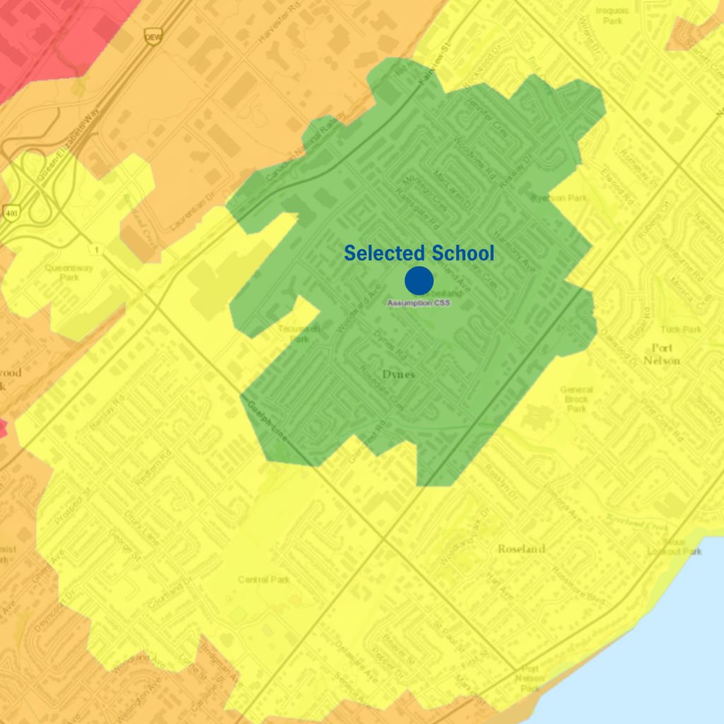
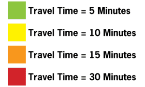
The map will show four shaded areas that estimate how long it would take to walk or bike to the selected school.
- Green area = estimated travel time of 5 minutes
- Yellow area = estimated travel time of 10 minutes
- Orange area = estimated travel time of 15 minutes
- Red area = estimated travel time of 30 minutes
Click here to try our interactive Walk & Roll Travel Time Map!
The assumptions the Walk & Roll Travel Time Map uses to determine the time required to travel a certain distance is:
Walking: Consists of a normal walking pace of about 5 km/hr.
Cycling: Consists of a normal cycling leisure pace of about 15 km/hr.
Please note that this map is only able to to determine an estimated amount of travel time as an individual’s actual speed will vary.